Clip by Asset
Last Updated: May 2020
In this tutorial you will use the shapefile uploaded using the file upload form to clip the dataset imagery. This will be done by uploading the shapefile to Google Earth Engine as an asset. Then the map will be reconfigured to check for the asset and clip the imagery if it exists. It will also use the bounding box of the asset to set the default map extent. The following topics will be reviewed in this tutorial:
Clipping Google Earth Engine Imagery
0. Start From Previous Solution (Optional)
If you wish to use the previous solution as a starting point:
git clone https://github.com/tethysplatform/tethysapp-earth_engine.git
cd tethysapp-earth_engine
git checkout -b file-upload-solution file-upload-solution-3.4
1. Stub out New Method for Uploading Shapefiles to GEE
In this step you will stub out a new GEE method called upload_shapefile_to_gee that will be responsible for uploading the shapefile provided by the user as an asset to GEE.
Create new
upload_shapefile_to_geefunction ingee/methods.pywith the following contents:
def upload_shapefile_to_gee(user, shp_file):
    """
    Upload a shapefile to Google Earth Engine as an asset.

    Args:
        user (django.contrib.auth.User): the request user.
        shp_file (shapefile.Reader): A shapefile reader object.
    """
    print(user.username)
    print(shp_file)
Import the new
upload_shapefile_to_geefunction and call it inhandle_shapefile_uploadfunction incontrollers.pyafter validating the shapefile upload. Also add an additionalexceptclause to handle any uncaught Google Earth Engine errors:
import ee
from .gee.methods import upload_shapefile_to_gee
def handle_shapefile_upload(request, user_workspace):
    """
    Uploads shapefile to Google Earth Engine as an Asset.

    Args:
        request (django.Request): the request object.
        user_workspace (tethys_sdk.workspaces.Workspace): the User workspace object.

    Returns:
        str: Error string if errors occurred.
    """
    # Write file to temp for processing
    uploaded_file = request.FILES['boundary-file']

    with tempfile.TemporaryDirectory() as temp_dir:
        temp_zip_path = os.path.join(temp_dir, 'boundary.zip')

        # Use with statements to ensure opened files are closed when done
        with open(temp_zip_path, 'wb') as temp_zip:
            for chunk in uploaded_file.chunks():
                temp_zip.write(chunk)

        try:
            # Extract the archive to the temporary directory
            with zipfile.ZipFile(temp_zip_path) as temp_zip:
                temp_zip.extractall(temp_dir)

        except zipfile.BadZipFile:
            # Return error message
            return 'You must provide a zip archive containing a shapefile.'

        # Verify that it contains a shapefile
        try:
            # Find a shapefile in directory where we extracted the archive
            shapefile_path = find_shapefile(temp_dir)

            if not shapefile_path:
                return 'No Shapefile found in the archive provided.'

            with shapefile.Reader(shapefile_path) as shp_file:
                # Check type (only Polygon supported)
                if shp_file.shapeType != shapefile.POLYGON:
                    return 'Only shapefiles containing Polygons are supported.'

                # Setup workspace directory for storing shapefile
                workspace_dir = prep_boundary_dir(user_workspace.path)

                # Write the shapefile to the workspace directory
                write_boundary_shapefile(shp_file, workspace_dir)

                # Upload shapefile as Asset in GEE
                upload_shapefile_to_gee(request.user, shp_file)

        except TypeError:
            return 'Incomplete or corrupted shapefile provided.'

        except ee.EEException:
            msg = 'An unexpected error occurred while uploading the shapefile to Google Earth Engine.'
            log.exception(msg)
            return msg
Navigate to http://localhost:8000/apps/earth-engine/viewer/ and upload the
USA_simplified.zip. Verify thatupload_shapefile_to_geeis called by noting the statements it prints to the terminal where Tethys is running.
2. Convert Shapefile to ee.FeatureCollection
The first step to uploading the shapefile as an asset is to convert it to an ee.FeatureCollection. However, ee API does not provide a way to create an ee.FeatureCollection directly from a shapefile. As an intermediate step, the shapefile will be converted first to GeoJSON, which can then be used to create the ee.FeatureCollection.
Update the
upload_shapefile_to_geefunction ingee/methods.pyto convert the uploaded shapefile to GeoJSON:
def upload_shapefile_to_gee(user, shp_file):
    """
    Upload a shapefile to Google Earth Engine as an asset.

    Args:
        user (django.contrib.auth.User): the request user.
        shp_file (shapefile.Reader): A shapefile reader object.
    """
    features = []
    fields = shp_file.fields[1:]
    field_names = [field[0] for field in fields]

    # Convert Shapefile to ee.Features
    for record in shp_file.shapeRecords():
        # First convert to geojson
        attributes = dict(zip(field_names, record.record))
        geojson_geom = record.shape.__geo_interface__
        geojson_feature = {
            'type': 'Feature',
            'geometry': geojson_geom,
            'properties': attributes
        }

        print(geojson_feature)
Navigate to http://localhost:8000/apps/earth-engine/viewer/ and upload the
USA_simplified.zip. Verify that the GeoJSON is being printed to the terminal where Tethys is running.Update the
upload_shapefile_to_geefunction ingee/methods.pyto convert createee.Featuresand anee.FeatureCollectionfrom the GeoJSON:
def upload_shapefile_to_gee(user, shp_file):
    """
    Upload a shapefile to Google Earth Engine as an asset.

    Args:
        user (django.contrib.auth.User): the request user.
        shp_file (shapefile.Reader): A shapefile reader object.
    """
    features = []
    fields = shp_file.fields[1:]
    field_names = [field[0] for field in fields]

    # Convert Shapefile to ee.Features
    for record in shp_file.shapeRecords():
        # First convert to geojson
        attributes = dict(zip(field_names, record.record))
        geojson_geom = record.shape.__geo_interface__
        geojson_feature = {
            'type': 'Feature',
            'geometry': geojson_geom,
            'properties': attributes
        }

        # Create ee.Feature from geojson (this is the Upload, b/c ee.Feature is a server object)
        features.append(ee.Feature(geojson_feature))

    feature_collection = ee.FeatureCollection(features)
    print(feature_collection)
Navigate to http://localhost:8000/apps/earth-engine/viewer/ and upload the
USA_simplified.zip. Verify that the newee.FeatureCollectionis printed to the terminal where Tethys is running.
3. Export the New ee.FeatureCollection to an Asset
Now that the shapefile has been converted to an ee.FeatureCollection, it can be exported as a Google Earth Engine table asset (see: Importing Table Data - Uploading a Shapefile). Remember that ee objects are server objects, which means the features are already on the server. Exporting the ee.FeatureCollection as an asset persists it to storage in the GEE cloud infrastructure so that you can use it again later without needing to upload it again. Similar to when the shapefile was written to the user's workspace, several helper functions will also be created to manage the folder where the asset will be written.
The
get_asset_dir_for_userwill create a folder for the user and return the path. function Create a newget_asset_dir_for_userfunction ingee/methods.pywith the following contents:
import os
def get_asset_dir_for_user(user):
    """
    Get a unique asset directory for given user.

    Args:
        user (django.contrib.auth.User): the request user.

    Returns:
        str: asset directory path for given user.
    """
    asset_roots = ee.batch.data.getAssetRoots()

    if len(asset_roots) < 1:
        # Initialize the asset root directory if one doesn't exist already
        ee.batch.data.createAssetHome('users/earth_engine_app')

    asset_root_dir = asset_roots[0]['id']
    earth_engine_root_dir = os.path.join(asset_root_dir, 'earth_engine_app')
    user_root_dir = os.path.join(earth_engine_root_dir, user.username)

    # Create earth engine directory, will raise exception if it already exists
    try:
        ee.batch.data.createAsset({
            'type': 'Folder',
            'name': earth_engine_root_dir
        })
    except EEException as e:
        if 'Cannot overwrite asset' not in str(e):
            raise e

    # Create user directory, will raise exception if it already exists
    try:
        ee.batch.data.createAsset({
            'type': 'Folder',
            'name': user_root_dir
        })
    except EEException as e:
        if 'Cannot overwrite asset' not in str(e):
            raise e

    return user_root_dir
The
get_user_boundary_pathfunction determines the path to the boundary asset for a given user. Create a newget_user_boundary_pathfunction ingee/methods.pywith the following contents:
def get_user_boundary_path(user):
    """
    Get a unique path for the user boundary asset.

    Args:
        user (django.contrib.auth.User): the request user.

    Returns:
        str: the unique path for the user boundary asset.
    """
    user_asset_dir = get_asset_dir_for_user(user)
    user_boundary_asset_path = os.path.join(user_asset_dir, 'boundary')
    return user_boundary_asset_path
Update the
upload_shapefile_to_geefunction ingee/methods.pyto call the newget_user_boundary_pathfunction and then export theee.FeatureCollectionto an asset at that path: (no try/except)
def upload_shapefile_to_gee(user, shp_file):
    """
    Upload a shapefile to Google Earth Engine as an asset.

    Args:
        user (django.contrib.auth.User): the request user.
        shp_file (shapefile.Reader): A shapefile reader object.
    """
    features = []
    fields = shp_file.fields[1:]
    field_names = [field[0] for field in fields]

    # Convert Shapefile to ee.Features
    for record in shp_file.shapeRecords():
        # First convert to geojson
        attributes = dict(zip(field_names, record.record))
        geojson_geom = record.shape.__geo_interface__
        geojson_feature = {
            'type': 'Feature',
            'geometry': geojson_geom,
            'properties': attributes
        }

        # Create ee.Feature from geojson (this is the Upload, b/c ee.Feature is a server object)
        features.append(ee.Feature(geojson_feature))

    feature_collection = ee.FeatureCollection(features)

    # Get unique folder for each user to story boundary asset
    user_boundary_asset_path = get_user_boundary_path(user)

    # Export ee.Feature to ee.Asset
    task = ee.batch.Export.table.toAsset(
        collection=feature_collection,
        description='uploadToTableAsset',
        assetId=user_boundary_asset_path
    )

    task.start()
Navigate to http://localhost:8000/apps/earth-engine/viewer/ and upload the
USA_simplified.zip. Verify that the path returned fromget_user_boundary_pathis printed to the terminal where Tethys is running.Warning
If you have already uploaded an asset, doing so again will fail because we haven't handled the case where the file already exists (see Step 3.7). Either manually delete the asset at https://code.earthengine.google.com/ or skip to step 3.8 for the implementation that handles this issue.
Navigate to https://code.earthengine.google.com/ and select the Tasks tab in the top-right pane of the code editor. Verify that a new
uploadToTableAssettask is/was running.Once the
uploadToTableAssettask is complete, select the Assets tab in the top-left pane of the code editor and verify that there is a new asset named boundary at the path that was printed to the terminal in step 3.4.Tip
If the new asset does not appear, try pressing the refresh button.
Navigate to http://localhost:8000/apps/earth-engine/viewer/ and upload the
USA_simplified.zipagain. TheuploadToTableAssettask in the Google Earth Engine code editor should fail, because Google Earth Engine won't let you overwrite a file that already exists when exporting an asset.Update the
upload_shapefile_to_geefunction ingee/methods.pyto delete the asset before exporting to asset. This will fail if there is no asset there (the first time), so handle with atry-except: (with try/except this time)
def upload_shapefile_to_gee(user, shp_file):
    """
    Upload a shapefile to Google Earth Engine as an asset.

    Args:
        user (django.contrib.auth.User): the request user.
        shp_file (shapefile.Reader): A shapefile reader object.
    """
    features = []
    fields = shp_file.fields[1:]
    field_names = [field[0] for field in fields]

    # Convert Shapefile to ee.Features
    for record in shp_file.shapeRecords():
        # First convert to geojson
        attributes = dict(zip(field_names, record.record))
        geojson_geom = record.shape.__geo_interface__
        geojson_feature = {
            'type': 'Feature',
            'geometry': geojson_geom,
            'properties': attributes
        }

        # Create ee.Feature from geojson (this is the Upload, b/c ee.Feature is a server object)
        features.append(ee.Feature(geojson_feature))

    feature_collection = ee.FeatureCollection(features)

    # Get unique folder for each user to story boundary asset
    user_boundary_asset_path = get_user_boundary_path(user)

    # Overwrite an existing asset with this name by deleting it first
    try:
        ee.batch.data.deleteAsset(user_boundary_asset_path)
    except EEException as e:
        # Nothing to delete, so pass
        if 'Asset not found' not in str(e):
            log.exception('Encountered an unhandled EEException.')
            raise e

    # Export ee.Feature to ee.Asset
    task = ee.batch.Export.table.toAsset(
        collection=feature_collection,
        description='uploadToTableAsset',
        assetId=user_boundary_asset_path
    )

    task.start()
Navigate to http://localhost:8000/apps/earth-engine/viewer/ and upload the
USA_simplified.zipagain. Verify that no error is shown this time.Navigate to https://code.earthengine.google.com/ after successfully uploading the shapefile. Verify that a new
uploadToTableAssettask is running and that the previous boundary asset has been removed. Once theuploadToTableAssetjob completes, the asset should once again be shown in the assets tab.
4. Use Boundary Asset to Clip Images
In this step you will modify the get_image_collection_asset method to attempt to retrieve the boundary asset and use it to clip the boundary if it exists.
The
get_boundary_fc_for_userwill retrieve the boundary asset and attempt to convert it to anee.FeatureCollection. If it succeeds, it will return theee.FeatureCollection, if it fails, the boundary asset likely has not been created so it will returnNone. Create a newget_boundary_fc_for_userfunction ingee/methods.pywith the following contents:
def get_boundary_fc_for_user(user):
    """
    Get the boundary FeatureClass for the given user if it exists.

    Args:
        user (django.contrib.auth.User): the request user.

    Returns:
        ee.FeatureCollection: boundary feature collection or None
    """
    try:
        boundary_path = get_user_boundary_path(user)
        # If no boundary exists for the user, an exception occur when calling this and clipping will skipped
        ee.batch.data.getAsset(boundary_path)
        # Add the clip option
        fc = ee.FeatureCollection(boundary_path)
        return fc
    except EEException:
        pass

    return None
Modify the
get_image_collection_assetfunction ingee/methods.pyto call the newget_boundary_fc_for_userfunction and clip the imagery if something is returned. Also add therequestas an argument as this is needed to get the current user:
def get_image_collection_asset(request, platform, sensor, product, date_from=None, date_to=None, reducer='median'):
    """
    Get tile url for image collection asset.
    """
    ee_product = EE_PRODUCTS[platform][sensor][product]

    collection = ee_product['collection']
    index = ee_product.get('index', None)
    vis_params = ee_product.get('vis_params', {})
    cloud_mask = ee_product.get('cloud_mask', None)

    log.debug(f'Image Collection Name: {collection}')
    log.debug(f'Band Selector: {index}')
    log.debug(f'Vis Params: {vis_params}')

    try:
        ee_collection = ee.ImageCollection(collection)

        if date_from and date_to:
            ee_filter_date = ee.Filter.date(date_from, date_to)
            ee_collection = ee_collection.filter(ee_filter_date)

        if index:
            ee_collection = ee_collection.select(index)

        if cloud_mask:
            cloud_mask_func = getattr(cm, cloud_mask, None)
            if cloud_mask_func:
                ee_collection = ee_collection.map(cloud_mask_func)

        if reducer:
            ee_collection = getattr(ee_collection, reducer)()

        # Attempt to clip the image by the boundary provided by the user
        clip_features = get_boundary_fc_for_user(request.user)

        if clip_features:
            ee_collection = ee_collection.clipToCollection(clip_features)

        tile_url = image_to_map_id(ee_collection, vis_params)

        return tile_url

    except EEException:
        log.exception('An error occurred while attempting to retrieve the image collection asset.')
Modify
get_image_collectioncontroller incontrollers.pyto callget_image_collection_assetwith therequestas an additional argument:
@login_required()
def get_image_collection(request):
    """
    Controller to handle image collection requests.
    """
    response_data = {'success': False}

    if request.method != 'POST':
        return HttpResponseNotAllowed(['POST'])

    try:
        log.debug(f'POST: {request.POST}')

        platform = request.POST.get('platform', None)
        sensor = request.POST.get('sensor', None)
        product = request.POST.get('product', None)
        start_date = request.POST.get('start_date', None)
        end_date = request.POST.get('end_date', None)
        reducer = request.POST.get('reducer', None)

        url = get_image_collection_asset(
            request=request,
            platform=platform,
            sensor=sensor,
            product=product,
            date_from=start_date,
            date_to=end_date,
            reducer=reducer
        )

        log.debug(f'Image Collection URL: {url}')

        response_data.update({
            'success': True,
            'url': url
        })

    except Exception as e:
        response_data['error'] = f'Error Processing Request: {e}'

    return JsonResponse(response_data)
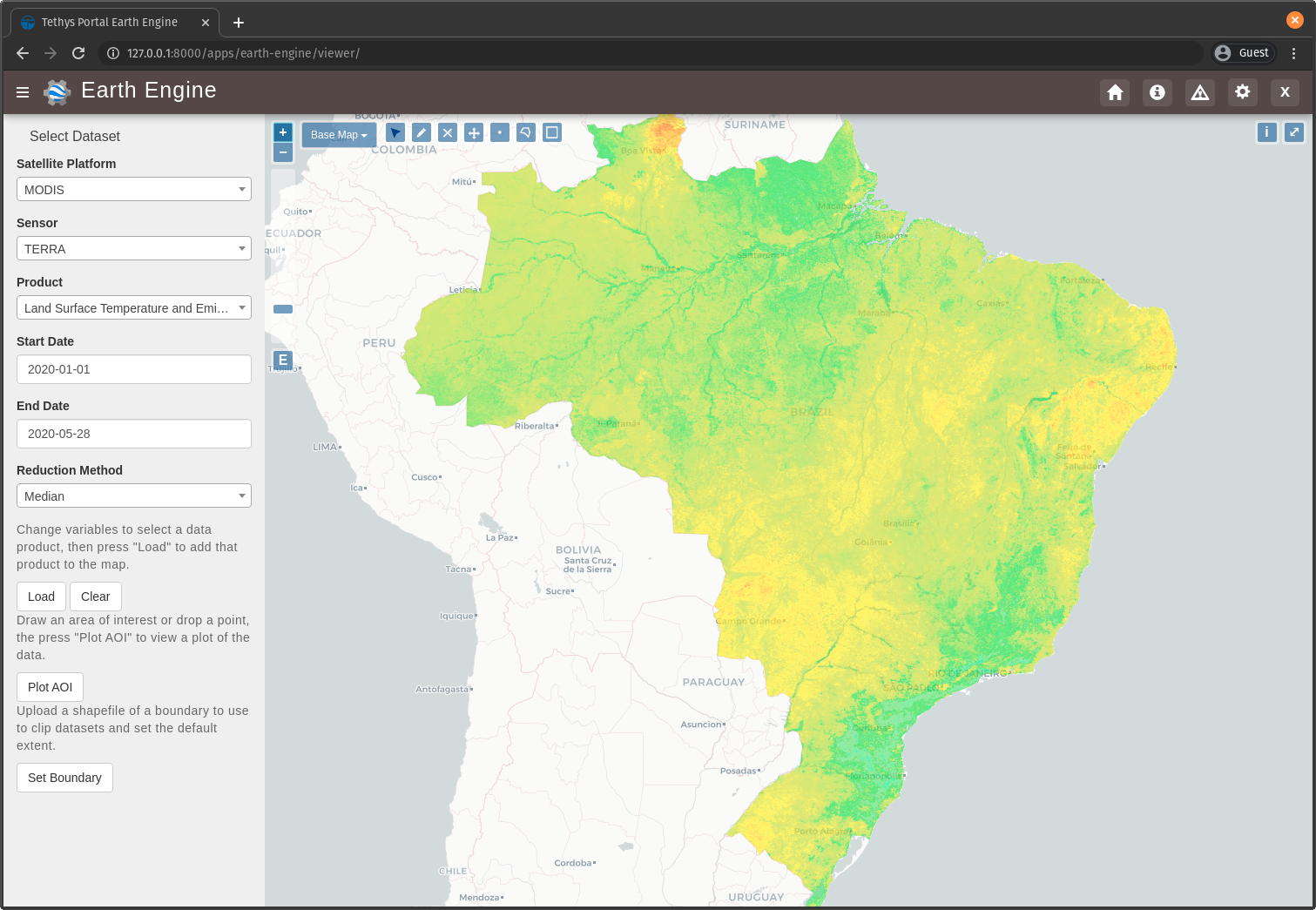
Navigate to http://localhost:8000/apps/earth-engine/viewer/ and load a dataset of your choice. Verify that the imagery has been clipped to the United States. You'll need to manually pan and zoom to the U.S. to see the imagery.
5. Use Boundary Asset for Map Extents
In this step you will modify the MapView on the Viewer page to use the extents of the boundary asset as the default map extents. If the user has not uploaded a boundary, the boundary asset will not exist, so the MapView will be changed to default to world extents.
The
get_boundary_fc_props_for_usermethod is responsible for determining various properties about the boundaryee.FeatureCollectionthat will be used by theMapView. These properties include thebounding_box,centroid, andzoomneeded to frame the features when the view is centered on the centroid. Create a newget_boundary_fc_props_for_userfunction ingee/methods.pywith the following contents:
import math
def get_boundary_fc_props_for_user(user):
    """
    Get various properties of the boundary FeatureCollection.
    Args:
        user (django.contrib.auth.User): Get the properties of the boundary uploaded by this user.

    Returns:
        dict<zoom,bbox,centroid>: Dictionary containing the centroid and bounding box of the boundary and the approximate OpenLayers zoom level to frame the boundary around the centroid. Empty dictionary if no boundary FeatureCollection is found for the given user.
    """
    fc = get_boundary_fc_for_user(user)

    if not fc:
        return dict()

    # Compute bounding box
    bounding_rect = fc.geometry().bounds().getInfo()
    bounding_coords = bounding_rect.get('coordinates')[0]

    # Derive bounding box from two corners of the bounding rectangle
    bbox = [bounding_coords[0][0], bounding_coords[0][1], bounding_coords[2][0], bounding_coords[2][1]]

    # Get centroid
    centroid = fc.geometry().centroid().getInfo()

    # Compute length diagonal of bbox for zoom calculation
    diag = math.sqrt((bbox[0] - bbox[2])**2 + (bbox[1] - bbox[3])**2)

    # Found the diagonal length and zoom level for US and Kenya boundaries
    # Used equation of a line to develop the relationship between zoom and diagonal of bounding box
    zoom = round((-0.0701 * diag) + 8.34, 0)

    # The returned ee.FeatureClass properties
    fc_props = {
        'zoom': zoom,
        'bbox': bbox,
        'centroid': centroid.get('coordinates')
    }

    return fc_props
Note
The zoom is derived from an overly simplistic analysis on two countries of different size. A boundary polygon for each country was uploaded and the diagonal distance across the bounding box was calculated for each country using the distance formula. The zoom level that framed each country was also noted. A linear equation was developed using the equation of a line and the points formed by the computed diagonal and zoom level. This equation is likely not very robust, but it works as a good first pass.
Use the
get_boundary_fc_props_for_userfunction to get the bounding box and zoom level to use for theMapView. Replace the definition of theMapViewin theviewercontroller incontrollers.pywith the following:
from .gee.methods import get_boundary_fc_props_for_user
# Get bounding box from user boundary if it exists
boundary_props = get_boundary_fc_props_for_user(request.user)

map_view = MapView(
    height='100%',
    width='100%',
    controls=[
        'ZoomSlider', 'Rotate', 'FullScreen',
        {'ZoomToExtent': {
            'projection': 'EPSG:4326',
            'extent': boundary_props.get('bbox', [-180, -90, 180, 90])  # Default to World
        }}
    ],
    basemap=[
        'CartoDB',
        {'CartoDB': {'style': 'dark'}},
        'OpenStreetMap',
        'Stamen',
        'ESRI'
    ],
    view=MVView(
        projection='EPSG:4326',
        center=boundary_props.get('centroid', [0, 0]),  # Default to World
        zoom=boundary_props.get('zoom', 3),  # Default to World
        maxZoom=18,
        minZoom=2
    ),
    draw=MVDraw(
        controls=['Pan', 'Modify', 'Delete', 'Move', 'Point', 'Polygon', 'Box'],
        initial='Pan',
        output_format='GeoJSON'
    )
)
Navigate to http://localhost:8000/apps/earth-engine/viewer/ and verify that the default extent now frames the United States. Pan and zoom away from the United States. Press the Fit to Extent button (the E button just below the zoom bar in the top-left-hand side of the map) and verify that it zooms to the extents of the United States.
Note
If a user has not uploaded a boundary, the default zoom will now encompass the globe. You can test this by deleting the boundary asset in the Google Earth Engine code editor.
6. Test and Verify
Browse to http://localhost:8000/apps/earth-engine/viewer/ in a web browser and login if necessary. Verify the following:
Upload a new zip archive containing a shapefile of the boundary of a country of your choice, other than the United States.
Navigate to https://code.earthengine.google.com/ and verify that a new
uploadToTableAssettask is kicked off.When the
uploadToTableAssettask completes, verify that the boundary asset has been created.Navigate back to http://localhost:8000/apps/earth-engine/viewer/ and refresh the page. Verify that the map frames the country whose boundary you uploaded.
Load a dataset of your choice and verify that the imagery is clipped by the boundary you uploaded.
7. Solution
This concludes this portion of the GEE Tutorial. You can view the solution on GitHub at https://github.com/tethysplatform/tethysapp-earth_engine/tree/clip-by-asset-solution-3.0 or clone it as follows:
git clone https://github.com/tethysplatform/tethysapp-earth_engine.git
cd tethysapp-earth_engine
git checkout -b clip-by-asset-solution clip-by-asset-solution-3.4